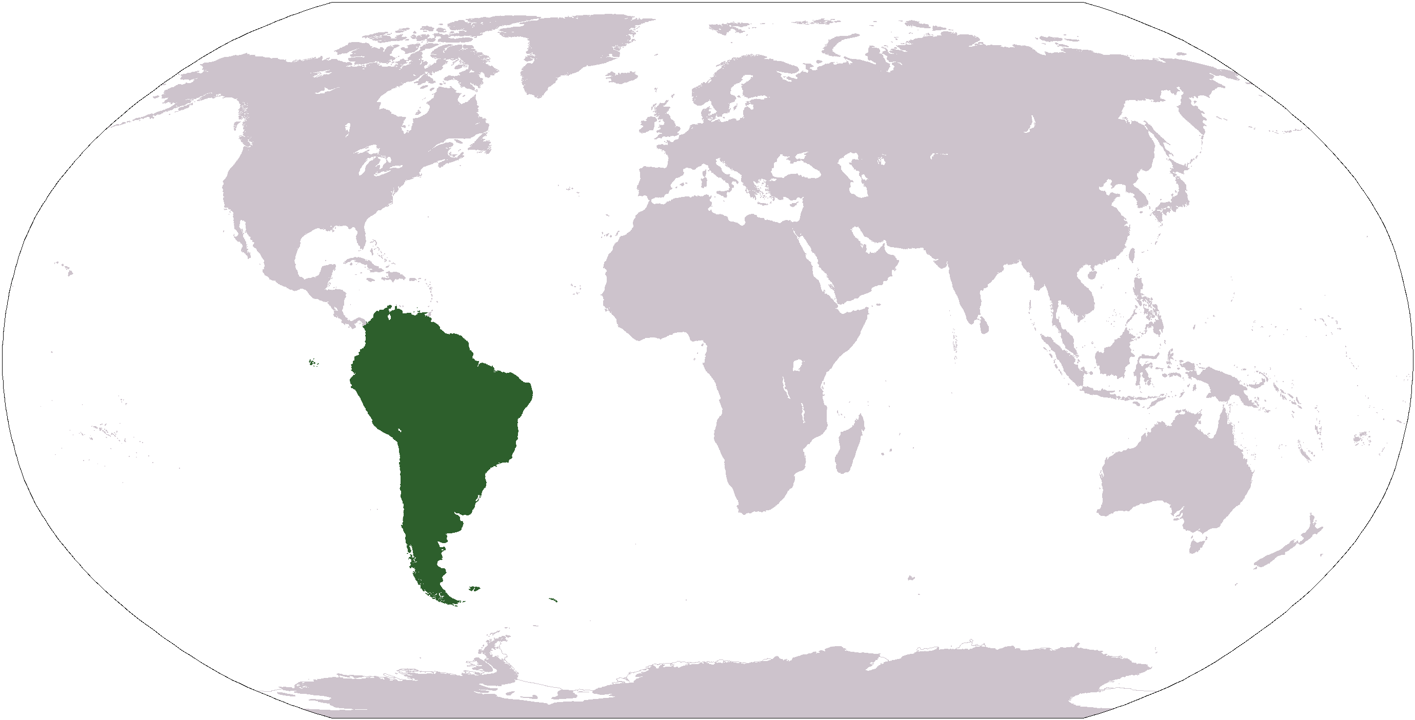
चित्र:LocationSouthAmerica.png
यै पूर्व रुपको आकार: ८०० × ४०७ पिक्सल। और रिजोल्युशनहरु: ३२० × १६३ पिक्सल • ६४० × ३२६ पिक्सल • १,०२४ × ५२१ पिक्सल • १,२८० × ६५१ पिक्सल • २,७५९ × १,४०४ पिक्सल।
खास फाइल (२,७५९ × १,४०४ पिक्सेलहरु, फाइल आकार: १०१ किलोबाइट, MIME प्रकार: image/png)

|
File:Location of South America.svg is a vector version of this file. It should be used in place of this PNG file when not inferior.
File:LocationSouthAmerica.png → File:Location of South America.svg
For more information, see Help:SVG. |
 |
| बेलिविस्तार |
Deutsch: Weltkarte mit Fokus auf Südamerika
English: World map depicting South America
Esperanto: Mondmapo bildiganta Sudamerikon
Español: Ubicación de América del Sur |
| मिति | (UTC) |
| स्रोत | map adapted from PDF world map at CIA World Fact Book |
| लेख्यामान्सु | Central Intelligence Agency, Maximaximax, Ghalas, Huhsunqu, E Pluribus Anthony, Cogito ergo sumo, and Snoopen82 (via Image:LocationSouthAmerica2.png per this request) |
| अन्य संस्करणहरू |
Derivative works of this file: Wikinews Ameryka Południowa.png Formerly Image:LocationSouthAmerica2.png. |
This image is in the public domain because it contains materials that originally came from the United States Central Intelligence Agency's World Factbook.
|
 |
फाइल इतिहास
तिथि/बेलामी क्लिक अरि तैबेला(समय) यो फाइल कसो थ्यो भणी हेद्द सकिन्याछ ।
| तिथि/बेला | थम्बनेल | आयाम | प्रयोगकर्ता | टिप्पणी | |
|---|---|---|---|---|---|
| यैलको | १८:२४, १९ जनवरी २००८ | | २,७५९ × १,४०४ (१०१ किलोबाइट) | F l a n k e r | Transparency |
| २३:४८, १६ अगस्ट २००७ |  | २,७५९ × १,४०४ (४६ किलोबाइट) | Jeff G. | Updated version without Panama per Commons:Administrators' noticeboard/Attention#Move_image_request_Image:LocationSouthAmerica2.png_to_Image:LocationSouthAmerica.png_.28user_account_too_new.29 | |
| १०:३५, १० सेप्टेम्बर २००६ |  | २,७५९ × १,४०४ (५५ किलोबाइट) | Cogito ergo sumo~commonswiki | World map: South America (location) | |
| १०:३३, २२ जनवरी २००६ |  | २,७५९ × १,४०४ (५५ किलोबाइट) | E Pluribus Anthony~commonswiki | World map: South America (location) | |
| ०४:१९, १६ जनवरी २००६ |  | १,३८१ × ७०३ (४८ किलोबाइट) | Huhsunqu | ||
| १८:१८, २९ अप्रिल २००५ |  | १,३८१ × ७०३ (१६ किलोबाइट) | Ghalas | Half the size {{PD-USGov-CIA-WF}} | |
| १४:१७, २८ अप्रिल २००५ |  | २,७५९ × १,४०४ (३९ किलोबाइट) | Ghalas | Extracted from CIA World Factbook PDF world map, then rasterized and colored. {{PD}} | |
| ११:१८, २९ डिसेम्बर २००४ |  | २५० × ११६ (११ किलोबाइट) | Maximaximax | Location of South America (from en:) {{GFDL}} |
फाइल उपयोग
यै चित्रमी निम्नपाना जोडिनान:
विश्वव्यापी फाइल प्रयोग
निम्न और विकिहरुमि यै फाइलको प्रयोग:
- ace.wikipedia.org मि उपयोग
- af.wikipedia.org मि उपयोग
- als.wikipedia.org मि उपयोग
- am.wikipedia.org मि उपयोग
- ang.wikipedia.org मि उपयोग
- ar.wikipedia.org मि उपयोग
- ar.wikinews.org मि उपयोग
- arz.wikipedia.org मि उपयोग
- as.wikipedia.org मि उपयोग
- azb.wikipedia.org मि उपयोग
- az.wikipedia.org मि उपयोग
- bat-smg.wikipedia.org मि उपयोग
येइ फाइलओ more global usage हेर: