चित्र:Johor location map.svg

Size of this PNG preview of this SVG file: ६२९ × ५९९ पिक्सल. और रिजोल्युशनहरु: २५२ × २४० पिक्सल • ५०४ × ४८० पिक्सल • ८०६ × ७६८ पिक्सल • १,०७५ × १,०२४ पिक्सल • २,१५० × २,०४८ पिक्सल • १,०३५ × ९८६ पिक्सल।
खास फाइल (SVG चित्र,सानतिनो १,०३५ × ९८६ पिक्सेलहरु, फाइल आकार: ६५ किलोबाइट)
फाइल इतिहास
तिथि/बेलामी क्लिक अरि तैबेला(समय) यो फाइल कसो थ्यो भणी हेद्द सकिन्याछ ।
| तिथि/बेला | थम्बनेल | आयाम | प्रयोगकर्ता | टिप्पणी | |
|---|---|---|---|---|---|
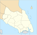
| यैलको | १८:५७, १३ जनवरी २०१८ |  | १,०३५ × ९८६ (६५ किलोबाइट) | Goran tek-en | {{Information |description ={{en|1=A map showing districts and PBT (local authorities) of Johor (blank version)<br> Approximate geographic limits of the map: *N 3.108806 *W 102.365112 *S 1.270019 *E 104.61731}} |date =20180113 |source... |
फाइल उपयोग
येइ फाइल प्रयोग भयाः कोइ लै पन्ना नाइथिन।
विश्वव्यापी फाइल प्रयोग
निम्न और विकिहरुमि यै फाइलको प्रयोग:
- en.wikipedia.org मि उपयोग
- Johor Bahru
- Pasir Gudang
- Rawa Island
- Pemanggil Island
- Besar Island, Johor
- Kukup
- Mersing
- Labis
- Senai International Airport
- Iskandar Puteri
- Ayer Hitam
- Yong Peng
- Sultan Abu Bakar State Mosque
- Pasir Pelangi Royal Mosque
- Sultan Ibrahim Jamek Mosque
- Pasir Gudang Jamek Mosque
- Jementah
- Parit Raja
- Bandar Tenggara
- Tampoi, Johor
- Perling
- Bukit Kepong incident
- Air Panas
- Kempas
- Mengkibol
- Tenggaroh
- Sagil
- Sungai Mati
- Parit Bakar
- Semerah
- Sri Medan
- Sungai Balang
- Sultan Ismail Jamek Mosque
- Bandar Baru UDA Jamek Mosque
- Tanjung Kupang
- Gemas Baru
- Tongkang Pechah
- Ungku Tun Aminah Jamek Mosque
- Kolam Ayer Mosque
- Lima Kedai
- Senggarang, Johor
- Sri Gading
- Wikipedia:WikiProject Malaysia/Cartography
- Seelong
- Kangkar Pulai
- Tebrau
- Pulau Merambong
- Taman Sri Lambak
- Muar (town)
- Batu Pahat (town)
येइ फाइलओ more global usage हेर: